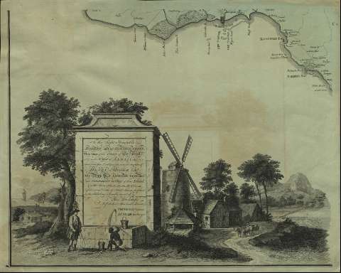
To the Right Honorable Robert Earl of Holdernesse, This...
Section: Maps, plans and nautical charts
Uniform title: JAMAICA. Mapas generales. 1763. 1:99891 (1761?)
Title: To the Right Honorable Robert Earl of Holdernesse, This Map of the County of Cornwall in the Island of Jamaica / (laid down from the Papers, and under the direction of Henry Moore Esqr. His Majesty's Lieutenant Governor and Commander in Chief of that Island, in the Years 1756-57-58-59-60 and 61 and from a great Number of Actual Surveys performed by the Publishers)... Thos. Craskell, Engineer, Jas. Simpson, Surveyor ; D. Fournier Sculp
Material or type of resouce Area: Escala [ca. 1:99.891]. 9 millas [= 14,5 cm]
Publication: Londini : Dal. Fournier, 1763
Physical description: 1 mapa en 4 h. : grab., col. ; h. de 53 x 65,4 cm
Content type: Imagen cartográfica
Media type: computadora
Carrier type: recurso en línea
Notes: Orientado con lis en rosa de 8 vientos
Tabla de signos convencionales para indicar plantaciones de azúcar, fondeaderos, molinos, divisiones administrativas, etc.
Título enmarcado en cartela arquitectónica barroca con escena costumbrista
Escala representada en conjunto arquitectónico
Materia / lugar / evento: Mapas generales
Divisiones administrativas
Jamaica
Other authors: Simpson, James, s. XVIII
Fournier, Daniel
Craskell, Thomas
UDC: 729.2
Type of publication:
![]() Maps
Maps
Préstamo:
![]() Disponible
Disponible


