A new and general map of the southern dominios belonging...


 Maps, plans and nautical charts
A new and general map of the southern dominios belonging to the United states of America : viz : North Carolina,... (1788)
Maps, plans and nautical charts
A new and general map of the southern dominios belonging to the United states of America : viz : North Carolina,... (1788)
 Disponible Holdings
 Section: Maps, plans and nautical charts
Uniform title: ESTADOS UNIDOS. SE. Colonias. 1:3254865 (1798)
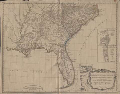
Title: A new and general map of the southern dominios belonging to the United states of America : viz : North Carolina, South Carolina, and Georgia : with the bordering Indian Countries, and the spanish possessions of Louisiana and Florida
Material or type of resouce Area: Escala [ca. 1:3.254.865]
Publication: London : Robert Sayer, 1788
Physical description: 1 mapa : col. ; 48 x 62 cm
Content type: Imagen cartográfica
Media type: computadora
Carrier type: recurso en línea
Notes: Escalas gráficas de 180 millas inglesas [= 9,8 cm] y 40 leguas náuticas [= 7,3 cm]
Constan coordenadas del meridiano de Londres
Inserta dos planos de población : Charlestown y St. Augustine
Materia / lugar / evento: Colonias
Estados Unidos
Other authors: Sayer, Robert, 1725-1794
UDC: 912:325.45(73)"1788"
73
Type of publication:
Maps
Rights:
Préstamo:
Disponible
