[Plano topográfico de Canela] : [Coruña]


 Disponible Holdings
 Section: Maps, plans and nautical charts
Uniform title: CANELA (La Coruña). Mapas topográficos. 1:500 (18)
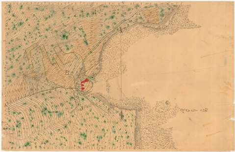
Title: [Plano topográfico de Canela] : [Coruña]
Material or type of resouce Area: Escala [1:500]
Publication: [18--?]
Physical description: 1 plano : ms., col., montado sobre tela ; 51'5x80'8 cm
Content type: Imagen cartográfica
Media type: computadora
Carrier type: recurso en línea
Notes: Título y subtítulo tomados del verso, manuscrito con posterioridad
Escrita al verso, con posterioridad, aparece escala numérica
Orientado con flecha N. al O.
Relieve representado por curvas de nivel
Manuscrito a plumilla en tinta negra, iluminado a la acuarela en verde, carmín, gris y siena
Materia / lugar / evento: Planimetría
S.XIX
La Coruña (Provincia)
UDC: 461.11 Canela
Type of publication:
 Maps
Maps
Rights:
Préstamo:
Disponible
