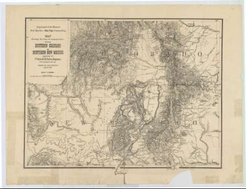
Map showing the lines of communication between Southern...
Section: Maps, plans and nautical charts
Title: Map showing the lines of communication between Southern Colorado and Northern New Mexico / compiled by 1st. Lieut. E.H. Ruffner, Engineers Chief Engineer, Dept. Mo. ; drawn by Ado Hunnius, Jan. 1st. 1876 ; Department of the Missouri Buet. Maj. Gen. John Pope, Commanding
Material or type of resouce Area: Escala 1:1000000
Publication: [Estados Unidos : [Nombre de editor no identificado], 1876?]
Physical description: 1 mapa : Papel agarbanzado ; 43 x 57 cm
Content type: Imagen cartográfica
Media type: computadora
Carrier type: recurso en línea
Notes: Coordenadas referidas a un meridiano que no se especifica
Relieve por normales
Indica las principales líneas ferroviarias mediante diferentes trazados
Materia / lugar / evento: Líneas ferroviarias
1876
Nuevo México
Other authors: Ruffner, E.H
Pope, John
Hunnius, Ado
UDC: 788-13
789-17
Type of publication:
![]() Maps
Maps
Préstamo:
![]() Disponible
Disponible


