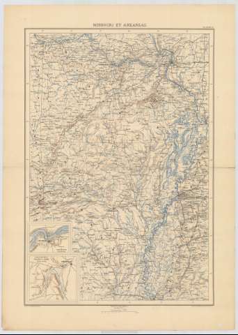
Missouri et Arkansas


Section: Maps, plans and nautical charts
Title: Missouri et Arkansas / dessiné par Ed. Dumas Vorzet ; gravé par L. Wuhrer
Material or type of resouce Area: Escala 1:1.500.000
Publication: Paris : Michel Lévy, [18--?]
Physical description: 1 mapa : col. ; 54 x 37 cm en h. de 64 x 46 cm
Content type: Imagen cartográfica
Media type: computadora
Carrier type: recurso en línea
Notes: Escala gráfica también expresada en kilómetros
Relieve representado por normales
Inserta: Environs de Lexington ; Champ de Bataille de Wilson's Creek
Materia / lugar / evento: Mapas generales
Planos de población
Núcleos de población
Ríos
Campos de batalla
S.XIX
Missouri
Arkansas
Estados Unidos
Other authors: Dumas-Vorzet, Edmond, 1841-1885
Wuhrer, L grabador
UDC: 778
767
Type of publication:
 Maps
Maps
Rights:
Préstamo:
 Disponible
