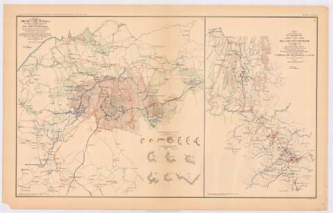
Map illustrating the siege of Atlanta, Ga. by the United...
Section: Maps, plans and nautical charts
Title: Map illustrating the siege of Atlanta, Ga. by the United States Forces under command of Maj. Gen. W.T. Sherman : from the passage of Peach Tree Creek, July 19th. 1864 to the commencement of the movement upon the enemy's lines of communication South of Atlanta August 26th. 1864 / surveyed and compiled under the direction of Capt. O.M. Poe... ; drawn in June, July, August and Sept. 1865 by Capt. H.A. Ulffers
Material or type of resouce Area: [Ca. 1:50291], 1 mile [= 3,2 cm]
Publication: Washington : Government Printing Office, [189-?] (N.Y. [Nueva York] : Julius Bien & co.)
Physical description: 1 mapa : col. ; 42 x 43 cm en h. de 47 x 75 cm
Content type: Imagen cartográfica
Media type: computadora
Carrier type: recurso en línea
Notes: Relieve representado por normales
Mapa que acompaña al informe del: "Capt. O.M. Poe..."
En margen inferior: Series I, vol. XXXVIII, part 1, page 137
Representadas mediante diferente color las posiciones de cada ejército
Inserta: "Rebel defenses of Atlanta". [Ca. 1:4121], 500 feets [= 3,7 cm] ; "7 croquis. U.S. defenses of Atlanta". ; [Ca. 1:3630], 500 feets [= 4,2 cm] ; 6 croquis
En: Atlas to accompany the Official Records of the Union and Confederate Armies 1861-1865. Pl. LXXXVIII, n. 1
Materia / lugar / evento: Sitios
Guerra civil
Fortificaciones
Baterías
Baluartes
Líneas ferroviarias
Carreteras
1864
Georgia (Estados Unidos)
Estados Unidos
Other authors: Sherman, W. T
Poe, O. M
Ulffers, H. A
UDC: 912:355.4]:[355.44:623.1/.2+725.963.2+625.1+625.7](758 Atlanta)'1864'
(758 Atlanta)
Type of publication:
![]() Maps
Maps
Préstamo:
![]() Disponible
Disponible


