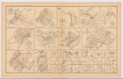
Sketch of the Cavalry engagement at Milford, Va. of Fitz...
Section: Maps, plans and nautical charts
Title: Sketch of the Cavalry engagement at Milford, Va. of Fitz Lee's Division : Wednesday, Sept. 21st, 1864 : N 25 / Top. Engr. Office, V.D. Feb. 22 1865 ; copied by S.B. Robinson
Material or type of resouce Area: Escala [ca. 1:31680], 2 Inches to 1 mille
Publication: Washington : Government Printing Office, [189-?] (N.Y. [Nueva York] : Julius Bien & co.)
Physical description: 1 mapa : col. ; 14x18 cm, en h. de 47x75 cm
Content type: Imagen cartográfica
Media type: computadora
Carrier type: recurso en línea
Notes: En : Atlas to accompany the Official Records of the Union and Confederate Armies 1861-1865. - Plate LXXXIV, n 1
Relieve : lineas perpendiculares normales
Figura leyenda de símbolos
Mapa que acompaña el informe del capt. Jed. Hotchkiss
Figura en margen inferior : Series 1. Vol XLIII. Part 1. Page 1027
En : Atlas to accompany the Official Records of the Union and Confederate Armies 1861-1865
Materia / lugar / evento: Guerra civil
Operaciones bélicas
Arma de Caballería
1864
Estados Unidos
Other authors: Hotchkiss, Jedediah
Estados Unidos. Topographical Engineer Office
UDC: 912:355.4]:357.1(755 Milford)'1864'
755 Milford
Type of publication:
![]() Maps
Maps
Préstamo:
![]() Disponible
Disponible


