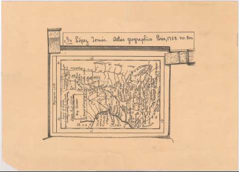
Atlas geográfico


Section: Maps, plans and nautical charts
Uniform title: Colombia. Mapas físicos. 1:5555550 (1758)
Title: Atlas geográfico / López Tomas
Edición: Ed. facs
Material or type of resouce Area: Esacala [ca. 1: 5.555.550]. 20 leguas españolas de 20 al grado [= 4 cm]
Publication: [Colombia] : [Nombre de editor no identificado], [1758?]
Physical description: 1 mapa ; 14 x 18 cm en h. de 25 x 35 cm
Content type: Imagen cartográfica
Media type: computadora
Carrier type: recurso en línea
Notes: Comprende la zona entre el río de la Magdalena hasta el mar del sur en Colombia
Reprod. facs. de la ed. París: [s.n.], 1758
Relieve representado por símbolos
Other authors: López, Tomás, 1730-1802
UDC: 861
Type of publication:
 Maps
Maps
Rights:
Préstamo:
 Disponible
