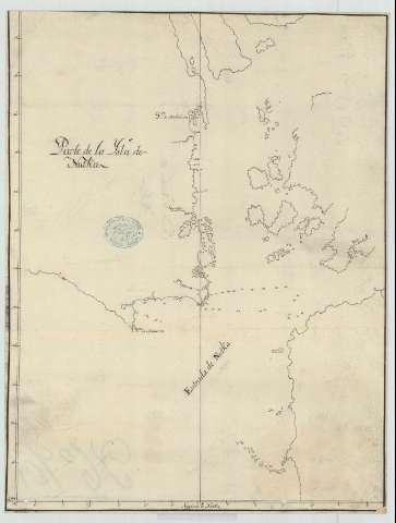
Plano de la Ysla de Nutka
Section: Maps, plans and nautical charts
Uniform title: NOOTKA (Canadá). Cartas náuticas. 1:54466 (17)
Title: Plano de la Ysla de Nutka / Ybañez
Material or type of resouce Area: Escala [ca. 1:54466]
Publication: 17--?]
Physical description: 1 carta náutica : ms., montado sobr tela ; 44,4 x 33,9 cm
Content type: Imagen cartográfica
Media type: computadora
Carrier type: recurso en línea
Notes: Mención de responsabilidad tomada del verso del documento
Escala hallada a partir de un minuto de latitud [= 3,4 cm]. Coordenadas referidas al meridiano de Nootka
Indica sondas batimétricas
Materia / lugar / evento: Cartas náuticas
Islas
Batimetría
Siglo XVIII
UDC: 71 Nootka
Type of publication:
![]() Maps
Maps
Archivo General Militar de Madrid
Location: PL — Call number: CAN-1/5 — Código de barras: 2121623
Préstamo:
![]() Disponible
Disponible
© Ministerio de Defensa de España
P. de la Castellana, 109 28071 Madrid.
Tlf: (34) 91 395 50 00
Email: patrimonio.cultural@oc.mde.es


