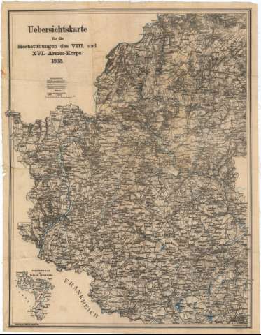
Vebersichtskarte fur die Herstubungen des VIII und XVI...


 Maps, plans and nautical charts
Vebersichtskarte fur die Herstubungen des VIII und XVI Armee - Korps 1893 (1893 ?)
Maps, plans and nautical charts
Vebersichtskarte fur die Herstubungen des VIII und XVI Armee - Korps 1893 (1893 ?)
 Disponible Holdings
 Section: Maps, plans and nautical charts
Uniform title: SARRE (Alemania) (Estado). Mapas generales. 1:200000 (1893)
Title: Vebersichtskarte fur die Herstubungen des VIII und XVI Armee - Korps 1893 / Schauenburgs geogr. Anst. Lahr.
Material or type of resouce Area: Escala 1:200000
Publication: Metz : Selbstuerlag von Registrator Roenigs, [1893 ?]
Physical description: 1 mapa : col., montado sobre tela ; 63,2x49,2 cm
Content type: Imagen cartográfica
Media type: computadora
Carrier type: recurso en línea
Notes: Presenta además un plano de conjunto
Coloreados en azul los ríos
Relieve representado por normales
Tabla de signos convencionales para indicar caminos, ferrocarriles, carreteras etc
Procede de la 'Colección Coello', N 77
Materia / lugar / evento: Mapas generales
Maniobras militares
1893
Lorena
Other authors: Selbstverlag von Registrator Roenigs (Metz)
UDC: 912:355.52(430-328 Sarre)'1893'
(44-328 Lorena)
Type of publication:
Maps
Rights:
Préstamo:
Disponible
