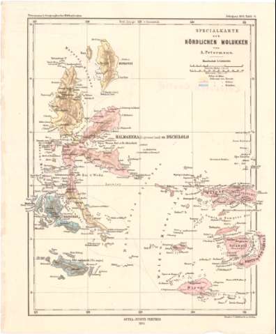
Special Karte der Nordlichen Molukken


Section: Maps, plans and nautical charts
Uniform title: MOLUCAS (Indonesia) (Islas). Mapas generales. 1:2500000 (1873)
Title: Special Karte der Nordlichen Molukken / von A. Petermann
Material or type of resouce Area: Escala 1:2500000 ; [proyec. Cónica] (E127°00'-E131°5'/N3°00'-S2°25')
Publication: Gotha : Justus Perthes, 1873 (in Gotha : Dauck N.C. Mellfonth)
Physical description: 1 mapa : col. ; 27,7x22,8 cm
Content type: Imagen cartográfica
Media type: computadora
Carrier type: recurso en línea
Notes: Red geográfica de 1° en 1°
Relieve representado por sombreados y puntos acotados
Pertenece al 'Petermann's Geographische Mittheilungen Jahrgang 1873, Tajel 11'
Procede de la 'Colección Coello'
Materia / lugar / evento: Mapas generales
1873
Other authors: Petermann, Augustus Herman
Perthes, Justus, 1749-1816
Hellfarth, C
UDC: 912(91-17 Molucas, islas)'1873'
91-17 Molucas, islas
Type of publication:
 Maps
Maps
Rights:
Préstamo:
 Disponible
