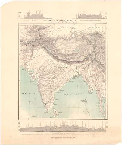
Sketch of the Mountains of India and its borders, A
Section: Maps, plans and nautical charts
Uniform title: India. Mapas físicos. 1:4000000 (1870)
Title: Sketch of the Mountains of India and its borders, A / By Trelawny Saunders, Geogr.
Material or type of resouce Area: Escala [ca. 1:14000000], 500 Statute Miles [= 5,9 cm] ; [proyec. cónica] (E62°30'-E105°25'/N41°30'-N4°30')
Publication: London : India Office, 1870 (Sold by the Agents for the sale of the India Government Maps)
Physical description: 1 mapa : col. ; 45,8x38,5
Content type: Imagen cartográfica
Media type: computadora
Carrier type: recurso en línea
Notes: Presenta 3 perfiles
Red geográfica de 10° en 10°
Relieve representado por normales
Other authors: Saunders, Trelawney
India. Government Maps
UDC: 912:551.43(540)'1870'
(548.7)
Type of publication:
![]() Maps
Maps
Préstamo:
![]() Disponible
Disponible


