Sketch Map of North Eastern India with portions of Burmah...


 Maps, plans and nautical charts
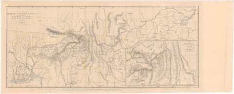
Sketch Map of North Eastern India with portions of Burmah & China (1867)
Maps, plans and nautical charts
Sketch Map of North Eastern India with portions of Burmah & China (1867)
 Disponible Holdings
 Section: Maps, plans and nautical charts
Uniform title: Asia. Mapas generales. 1:10000000 (1867)
Title: Sketch Map of North Eastern India with portions of Burmah & China
Material or type of resouce Area: [Ca. 1:10000000], 200 English Miles [= 5,5 cm]
Publication: London : Published for The Journal of The Royal Geographicae Society by J. Murray Albemarle Sheet, 1867
Physical description: 1 mapa : col. ; 19,5 x 45,5 cm en h. de 22 x 57 cm
Content type: Imagen cartográfica
Media type: computadora
Carrier type: recurso en línea
Notes: Presenta además un mapa de "Asam, Burmah, China"
Escala grafica de 200 Geographical Miles [= 6 cm]. Coordenadas referidas al parecer al meridiano de Londres (E 88°0'-112°25'/N 30°25'-20°50'). Red geografica de 2 en 2°
Relieve representado por normales
Notas manuscritas al parecer de D. Francisco Coello
Other authors: Murray, John
UDC: 912(5-191.2)'1867'
5-191.2
Type of publication:
Maps
Rights:
Préstamo:
Disponible
