Prag, Eger, Budweis, Linz, Munchen, Regensburg


 Disponible Holdings
 Section: Maps, plans and nautical charts
Uniform title: ALEMANIA. E. Mapas generales. 1:750000 (1884)
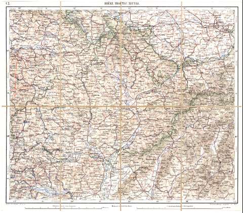
Title: Prag, Eger, Budweis, Linz, Munchen, Regensburg / Schirft u. Gerrippe v. Assist. M. Jakupec ; Terroinschaffirung v. Hptm. Josef Fendl
Material or type of resouce Area: 1:750000 ; [proyec. cónica]
Publication: [Deutschland : [Editor no identificado]], 1884
Physical description: 1 mapa : col., montado sobre tela ; 36,4 x 42 cm
Content type: Imagen cartográfica
Media type: computadora
Carrier type: recurso en línea
Notes: Comprende al oeste de Checoslovaquia y el este de Alemania
Escalas gráficas de 90 Kilómetros [= 12,1 cm] y 10 millas geográficas [= 10 cm]. Coordenadas referidas al meridiano de Hierro (E 29°00'-E 32°55'/N 50°30'-N 48°15'). Red geográfica de 1° en 1°
Relieve representado por normales
En el ángulo superior izquierdo: "B. 2"
Indica fronteras en verde
Entelado en 8 cuarterones
Materia / lugar / evento: Mapas generales
Fronteras
1884
Checoslovaquia
Alemania
Other authors: Fendl, Josef
Jakupec, M
UDC: 912:341.222(430-11)'1884'
(437-15)
Type of publication:
 Maps
Maps
Rights:
Préstamo:
Disponible
