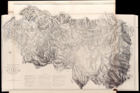
Attack made by the Allies under the Marquis of Wellingon...
Section: Maps, plans and nautical charts
Uniform title: NIVELLE (Francia). Operaciones militares. 1840. Escala [ca. 1:25.500]. 2 Miles [= 12'6 cm] (1813)
Title: Attack made by the Allies under the Marquis of Wellingon on the fortified Position of the Nivelle : occupied by the French Army commanded by Marshal Soult, upon the 10th of Nov.r 1813 [Material cartográfico] / on zinc by H.C. Maguire ; from a Drawing by Major Sir Tho. Mitchell
Material or type of resouce Area: Escala [ca. 1:25.500]. 2 Miles [= 12'6 cm]
Physical description: 1 mapa ; 84 x 64 cm
Notes: Relieve representado por normales
Vegetación representada en algunas zonas
Leyenda explicativa con el desarrollo de la contienda
Materia / lugar / evento: Operaciones militares
Batallas
Guerras de independencia
1813
Pirineos Atlánticos
Francia
Gran Bretaña
UDC: 460
Type of publication:
![]() Articles and chapters
Articles and chapters


