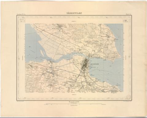
Tagerwilen


Section: Maps, plans and nautical charts
Uniform title: Suiza. Mapas topográficos. 1:25000 (1885)
Title: Tagerwilen / gest. v. H. Mullhaupt v. Sohn
Material or type of resouce Area: Escala 1:25000 ; [proyec. cónica]
Publication: [Schweiz ? : Topographischen Bureau ?], 1885?]
Physical description: 1 mapa : col. ; 30x40,6 cm, en h. de 40,8x51,7 cm
Notes: Comprende las ciudades suizas de Konstanz y Tagerwilen y la alemana Wollmatingen
Pertenece al 'Topographischen Atlas de Schweiz'. - Section IV. Ze. Hoja 51
Coordenadas referidas a un meridiano que no se especifica (E6°46'00''-E6°53'00'/N47°41'40''-N47°38'10''). Red geográfica de 1° en 1°
Relieve representado por curvas de nivel de 10 metros de equidistancia
En el ángulo superior derecho : mapa índice
Sello en seco del Topographischen Bureau
Materia / lugar / evento: Mapas topográficos
1885
Tagerwilen
Konstanz
Wollmatingen
Other authors: Mullhaupt, H.H
Sohn
Suiza. Topographisches Bureau
UDC: 912:528.4(494-17)'1885'
(494 Tagerwilen)
(494 Konstanz)
(430 Wollmatingen)
Type of publication:
 Maps
Maps
Rights:
Préstamo:
 Disponible
