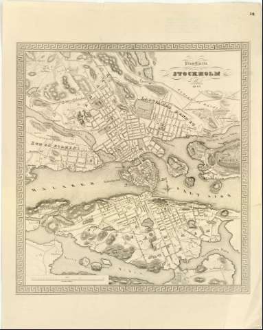
Plan - Karta ofver Stockholm


Section: Maps, plans and nautical charts
Uniform title: ESTOCOLMO (Suecia). Planos de población (1843). 1:5000
Title: Plan - Karta ofver Stockholm / Sommandragen och Graverad isten af C.F. Strom
Material or type of resouce Area: Escala [ca. 1:5000]
Publication: [Stockholm ? : [Editor no identificado]], 1843
Physical description: 1 plano ; 44x41 cm en h. de 61,7x49,3 cm
Content type: Imagen cartográfica
Media type: computadora
Carrier type: recurso en línea
Notes: Orientado con estrella
Relieve representado por normales y sombreado
En el ángulo superior derecho : '10'
Other authors: Strom, C.F
UDC: 912:314(485 Estocolmo)'1843'(084.3)
485 Estocolmo
Type of publication:
 Maps
Maps
Rights:
Archivo Cartográfico de Estudios Geográficos del Centro Geográfico del Ejército
Location: AR — Call number: Ar.K-T.5-C.1-12 — Código de barras: 2209860
Préstamo:
 Disponible

© Ministerio de Defensa de España
P. de la Castellana, 109 28071 Madrid.
Tlf: (34) 91 395 50 00
Email: patrimonio.cultural@oc.mde.es