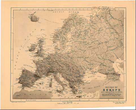
Photo - Relief Map of Europe


Section: Maps, plans and nautical charts
Uniform title: Europa. Mapas físicos. 1:11000000 (1885)
Title: Photo - Relief Map of Europe / by Henry F. Brion and Reud. Edmund Mc. Clure, M.A.
Material or type of resouce Area: Escala [ca. 1:11000000], 500 British Miles [= 7 cm] (O5°0'-E45°25'/N60°35'-N30°55')
Publication: London : Published by The Society for Promotinc Christian Knowledge Northumberland Avenue Charing Cron, 1885
Physical description: 1 mapa ; 32x40 cm en h. de 38x52 cm
Content type: Imagen cartográfica
Media type: computadora
Carrier type: recurso en línea
Notes: Relieve representado por sombreado
En el margen inferior izquierdo 'Heights are given en Feet Above sea Level'
Other authors: Brion, Henry F
Clure, Mc Edmund
Society for Promoting Christian Knowledge (Londres)
UDC: 912:[551-43:556.63](4)'1885'
4
Type of publication:
 Maps
Maps
Rights:
Préstamo:
 Disponible
