North Anna


Section: Maps, plans and nautical charts
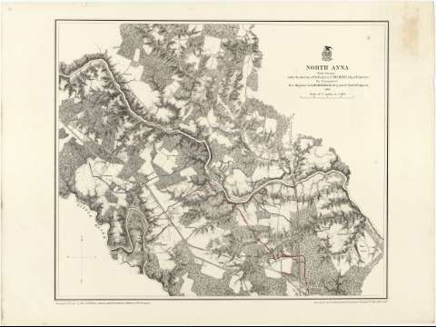
Title: North Anna / from surveys under the direction of But. Brig. Gen. N. Michler, Maj. of Engineers by Command of But. Maj. Genl. A.A. Humphreys, Brig. Genl. & Chief of Engineers. 1867 ; Surveyed & drawn by Maj. J.E. Weyss, assisted by F. Theilkuhl, J. Strasser & G. Thompson
Material or type of resouce Area: Escala [ca. 1:21120]
Publication: [New York] : Photolith. by the N.Y. Lithographing, Engraving & Printing Co., Julius Bien Supt., 1867
Physical description: 1 mapa : col. ; 40 x 48 cm
Content type: Imagen cartográfica
Media type: computadora
Carrier type: recurso en línea
Notes: Comprende los alrededores de New Market, destacándose en rojo las posiciones ocupadas por el ejército Confederado y en azul las de las tropas de la Unión
Escala nominal de 3 pulgadas por milla. Orientado con flecha, con las iniciales de los puntos cardinales
Orografía por normales
Sobre el titulo figura impreso un escudo, posiblemente de la Secretaría de Guerra
Relacionado con los mapas J-2-3-151 a 166
Materia / lugar / evento: Operaciones bélicas
Mapas topográficos
Estrategia militar
1867
Virginia
Estados Unidos
Other authors: Michler, N
Weyss, J. E
Theilkuhl, F
Strasser, J
Thompson, J
Julius Bien & Co
UDC: 912:355.4:355.43(755)"1867"
755 North Anna
Type of publication:
 Maps
Maps
Rights:
Préstamo:
 Disponible
