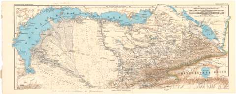
Nordliche Fortsetzung der original Karte des Centralen...
Section: Maps, plans and nautical charts
Uniform title: TURKESTAN. SE. Mapas generales. 1:1100000 (1875)
Title: Nordliche Fortsetzung der original Karte des Centralen Theiles des Tians - chan - Gebircssystems, umfassend die Seenzone des Balkasch - Alakul & Das Siebenstromland / Von A. Petermann ; Bearbeitet v. H. Habenicht
Material or type of resouce Area: Escala 1:1100000 ; [proyec. cónica] (E73°30'-E82°30'/N46°45'-N44°20')
Publication: Gotha : Justus Perthes, 1875 (Berlin : Lith. Institut v. Wilh Greve)
Physical description: 1 mapa : col. ; 25'2x64'2 cm en h. de 27'9x70'3 cm
Content type: Imagen cartográfica
Media type: computadora
Carrier type: recurso en línea
Notes: Comprende el sureste de la región de Turquestán
Pertenece al 'Petermann's Genar. Mittheilungen, Erganzungsheft, N 43'
Coordenadas además referidas al meridiano de Pulkowa (E43°05'-E52°10'/N46°45'-N44°20'). Red geográfica de 1° en 1°
Relieve representado por sombreado. Sondas batimétricas
Procede de la 'Colección Coello'
Other authors: Hobenicht, Hermann
Petermann, Augustus Herman
Perthes, Justus, 1749-1816
Grece, Wilhelm
UDC: 912:556.55(47-328 Turquestán)'1875'
Type of publication:
![]() Maps
Maps
Préstamo:
![]() Disponible
Disponible


