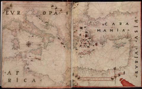
[Atlas portulano]
Section: Maps, plans and nautical charts
Title: [Atlas portulano] / Joannes Oliva fecit in nobile urbe Messane anno 1596
Author: Oliva, Joan, fl. 1580-1615
[Atlas portulano (1596)] All editions
Characteristics of the edition: Italiano
Material or type of resouce Area: Varias escalas
Publication: 1596
Physical description: 1 atlas (11 cartas) : ms., col., perg. ; 32 cm
Notes: Título tomado del Catálogo de Atlas del Servicio Geográfico del Ejército, 1962 (p. 21)
Mención de responsabilidad tomada de la primera carta naútica, en la que figura firma manuscrita del autor
Escalas gráficas representadas en tronco de leguas de 1º en filacterias
Orientadas con lis en rosas de los vientos de 16 rumbos. Nudos de rumbos
Líneas meridianas graduadas en algunas cartas, representando la longitud
Precediendo a las cartas, portada manuscrita "Mapamundi. Atlas marítimo por D. Juan de Oliva. 1596. Depósito Topográfico Militar" y frontispicio renacentista, decorado con un querubín que sustenta los dos hemisferios sobre una vista del puerto de Mesina
Manuscrito sobre pergamino en tinta negra, iluminado en sepia, verde y carmín
Mención de responsabilidad en latín. Toponimia en italiano
Contains: [1. Insulindia e Sud-est asiatico] - [2. Africa settentrionale] - [3. Africa australe] - [4. Africa orientale, Arabia e India] - [5. America Centrale, Messico e Perù ] - [6. America Meridionale, Patagonia e Tierra de Fuego] - [7. Nord-est dell'America del Sud ] - [8. Mar dei Caraibi e le coste adiacenti ] - [9. Nord Atlantico] - [10. Europa e Mediterraneo Occidentale] - [11. Mediterraneo Orientale]
Included records: [Africa australe]
[Africa orientale, Arabia e India]
[...] Ver todos los registros incluidos (11)
Materia / lugar / evento: Atlas - Obras anteriores a 1800
Genre / form: Atlas
Manuscritos
Cartas náuticas
UDC: (100)
Type of publication:
![]() Maps
Maps
Préstamo:
![]() Disponible
Disponible


