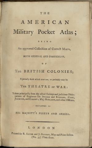
The American Military Pocket Atlas : being an approved...
Section: Maps, plans and nautical charts
Uniform title: AMERICA DEL NORTE. Mapas generales. Varias escalas (1776)
Title: The American Military Pocket Atlas : being an approved collection of correct maps, both general and particular of the British Colonies : especially those which now are, or probably maybe the theatre of War : Taken principally from the actual Surveys and judicious Observations of Engineer De Brahm and Romans, Cook, Jackson and Collet, Maj. Holland, and other Officiers, employed in this Majesty's Fleets and Armies
Material or type of resouce Area: Varias escalas
Publication: London : Printed for R. Sayer and J. Bennett, map and Print Seller (n° 53), Fleet street, [1776]
Physical description: 1 atlas ([6] p.) : 6 lám., col. ; 23 cm
Content type: Imagen (cartográfica ; fija ; bidimensional ; visual)
Media type: sin mediación
Notes: Fecha tomada de: "Toley's Dictionary of Mapmakers", 1979
Nota explicativa sobre la realización y el alcance del atlas
Contenido incompleto: 1. North America as divided amongst the European Powers - 2. A compleat map of the West Indies containing the coast of coast of Florida, Louisiana, New Spain and Terra Firma with all the Islands - 3. A General Map of the Norther British Colonies in America Wich comprehends the Province of Quebec, the Government of Newfoundlsland, Nova-Scotia, New England and New York - 4. A General Map of the Middle British Colonies in America containing Virginia, Maryland, the Delaware countries, Pennsylvania and New Yersey, with the addition of New York and of Greatest Part of New England, as also of the Bodering Parts of the province of Quebec - 5. A General Map of the Southern British Colonies in America comprehending North and South Carolina, Georgia, East and West Florida with the Neighbouring Indian Countries - 6. A Survey of Lake Champlain, including lake George, Crown Point and St. John
Included records: Compleat Map of the West Indies : Containing the Coasts of Florida, Louisiana, New Spain and Terra Firma with all the Islands. - London : Printed for Robt. Sayer, Nº 53 in Fleet Street, as the Act directs, 10 Janvary [1776]
General Map of the Middle British Colonies, in America : containing Virginia, Maryland, the Delaware Countils, Pennsylvania and New Jersey, With the addition of New York, and of the Greatest Part of New England, as also of the Bordering Parts of the Province of Quebec, improved from several Surveys made after the late War. - London : Printed for R. Sayer & Bennet, Map. Chart & Printseller, N° 53, Fleet Street, as the Act directs., 15 th. Oct. 1776
[...] Ver todos los registros incluidos (6)
Materia / lugar / evento: Mapas generales
Colonias
Mares
Atlas
1776
América del Norte
América Central
Caribe (Mar)
Other authors: Robert Sayer and John Bennett (Firma)
UDC: (7/728.9)
Type of publication:
![]() Maps
Maps
Préstamo:
![]() Disponible
Disponible


