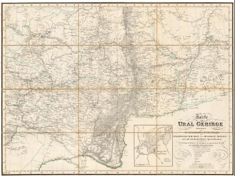
Karte vom Ural Gebirge
Section: Maps, plans and nautical charts
Uniform title: URALES (Montes). Mapas generales. 1:2000000 (188)
Title: Karte vom Ural Gebirge / Gegrundet auf die astronomischen Beobachtungen von Wischnewsky... [et all] und auf handschriftliché specialkarten Als Beilage zu G. Rose's Mineralogisch - geognostischom Berich von Humboldts Sibirischer Reise
Material or type of resouce Area: Escala 1:2000000 ; [proyec. estereográfica]
Publication: [Deutschland : s.n., 188-]
Physical description: 1 mapa : montado sobre tela ; 55,5x75 cm
Notes: Presenta ademas un mapa de 'Bjelaja Gora mit den Umgebungen'
Escala gráfica de 140 verstas [= 7,4 cm], 20 millas alemanas [= 7,3 cm] y 80 millas geográficas [= 7,3 cm]. Coordenadas referidas al meridiano de Paris (E46°-E66°/N60°-N51°). Red geográfica de 1° en 1°
Relieve representado por normales
Tabla de signos convencionales para indicar divisiones administrativas, oficinas de postas, plazas fuertes, etc.
Indica divisiones administrativas en color
Materia / lugar / evento: Mapas generales
S.XIX
Other authors: Humboldt, Alexander von, 1769-1859
Wischnewsky
UDC: 912(234 Urales)'1880/1889'
234 Urales
Type of publication:
![]() Maps
Maps
Préstamo:
![]() Disponible
Disponible


