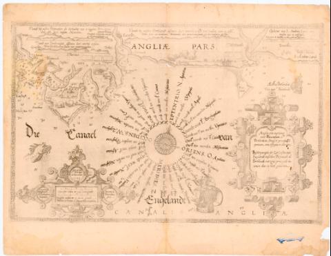
Beschryumghe der Zee Custen van Engelandt tuschen...
Section: Maps, plans and nautical charts
Uniform title: INGLATERRA (Reino Unido). SO. Cartas náuticas. 1:370000 (1583)
Title: Beschryumghe der Zee Custen van Engelandt tuschen Pleijmouth en Porthlandt, met zifne principale havene esex in hare gedaenten = Angliae orae maritimae inter Plemoutham et Portlandiam simul et praecipuarii portuum vera effiges et delineatio / Lucas Iansz Waghenaer va Enchifsent Inventor ; Ioannes á Doetinchem fecit
Material or type of resouce Area: Escala [ca. 1:370000] 3 miliana Germanica to 15 in cm gruedt [= 6 cm]
Publication: [Holanda] : s.n., [1584-1585]
Physical description: 1 Carta nautica ; 33x52 cm en h. de 41x54 cm
Notes: Presenta ademas 4 perfiles
Pertenece al Atlas 'Sphiegle der Zeevaer'. - 1584-85. - 21
Escala grafica de '3 Spaen fche mulen to 17 1/2 in cen graedt' [= 6 cm] Orientado con lis con rosa de 8 vientos
Relieve representado por sondas batimetricas
Indica veriles bajos y fondeaderos
Leyenda explicativa al verso del mapa
Indica nombre de los vientos
Titulo enmarcado en cartela renacentista, al igual que la escala y mención de responsabilidad
Representación de 2 galeras y monstruos marinos
Procede de la colección Rico y Sinobas
Other authors: Waghenaer, Lucas Jansz (ca. 1533-1606)
Doetecum, Jan van
UDC: 912:551.46]:528.9(410-328 Inglaterra)'1583'
(410-Portland)
(410 Pijmouth)
Type of publication:
![]() Maps
Maps
Préstamo:
![]() Disponible
Disponible


