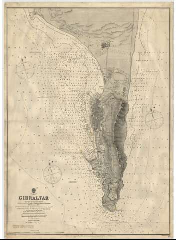
Gibraltar


Section: Maps, plans and nautical charts
Uniform title: Gibraltar. Cartas náuticas. 1:12140 (1889)
Title: Gibraltar / Surveyed by Captain P. Aldrich ; assisted by Lientts. A. Havergal, C.J. Baker, H.B. Anson and W. Richardson ; Engraved by Edwa. Weller
Edición: Ed. corr.
Material or type of resouce Area: Escala 1:12.140
Publication: London : Published at the Admiralty, 1889
Physical description: 1 plano : montado sobre tela ; 69x49 cm
Content type: Imagen cartográfica
Media type: computadora
Carrier type: recurso en línea
Notes: Edición de 1885, publicada el 12 de Junio 1886, corregida en VII-89
Coordenadas respecto al meridiano de Grenwich
Orientado al N. y N. magnético. Variación 17 10'. W.
Relieve representado por normales
Batimetría. Veriles
Indicados los faros en amarillo y rojo
Indicada la composición de los fondos marinos
Precede al título, escudo del 'Hidrographic Office', debajo del mismo: 'Price Eighteenpence'
Debajo de la mención de responsabilidad: 'H.M.S. Sylvia'
Reproducción digital. Madrid : Ministerio de Defensa. Archivo General Militar de Madrid
Materia / lugar / evento: Planos de población
Gibraltar
Other authors: Havergal, A
Baker, C. J
Anson, H.B
Richardson, W
Weller, Edward
UDC: 262.112 Estrecho de Gibraltar
Type of publication:
 Maps
Maps
Rights:
Préstamo:
 Disponible
