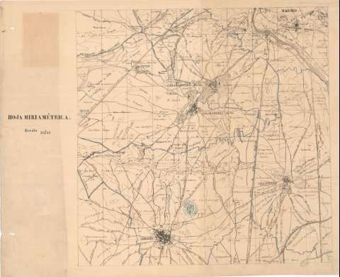
[Madrid y sus contornos] : Hoja miriamétrica


 Disponible Holdings
 Section: Maps, plans and nautical charts
Uniform title: Madrid. Mapas generales. 18. 1:200.000
Title: [Madrid y sus contornos] : Hoja miriamétrica
Material or type of resouce Area: Escala 1:200.000
Publication: [Lugar de publicación no identificado] : [Nombre de editor no identificado], [18--?]
Physical description: 1 mapa en 4 h. : col. ; 111x147 cm, en h. de 56x79 cm
Content type: Imagen cartográfica
Media type: computadora
Carrier type: recurso en línea
Notes: Título facticio
Relieve representado por curvas de nivel, equidistantes 10 metros
Toponímia. Indicados caminos
Reproducción digital. Madrid : Ministerio de Defensa. Archivo General Militar de Madrid
UDC: 464.1 Madrid
Type of publication:
 Maps
Maps
Rights:
Préstamo:
Disponible
Préstamo:
Disponible
Préstamo:
Disponible
Préstamo:
Disponible
