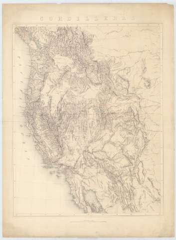
Sketch Map of the cordilleras of the western United States


 Disponible Holdings
 Section: Maps, plans and nautical charts
Uniform title: Estados Unidos. Mapas generales. 1876 (1876?). 1:3801600
Title: Sketch Map of the cordilleras of the western United States / [Clarence King]
Material or type of resouce Area: Escala [ca. 1:3801600], 60 Miles to 1 Inch
Publication: [Washington D.C. : Engineer Department, 1876]
Physical description: 1 mapa ; 69 x 55
Content type: Imagen cartográfica
Media type: computadora
Carrier type: recurso en línea
Notes: Comprende la parte occidental de los Estados Unidos, al este de los estados de Montana, Wyoming, Colorado y Nuevo México
Mención de responsabilidad y pie de imprenta tomados de la portada del atlas
Escala también dada en forma gráfica de 200 millas legales [= 8'9 cm]
Relieve por sombreado
Indica la exploración geográfica realizada en esta zona, señalándose además el área recogida en cada uno de los mapas que, junto a este, componen el mencionado atalas
Pertenece al: "Geological and Topographical Atlas"
Materia / lugar / evento: Mapas generales
Divisiones administrativas
Mapas índices
1876
Other authors: King, Clarence
Estados Unidos. Army. Corps of Engineers
UDC: 73-15
Type of publication:
 Maps
Maps
Rights:
Préstamo:
Disponible
