Preliminary Chart Lower Reach of Saginaw river and Bar in...


 Maps, plans and nautical charts
Preliminary Chart Lower Reach of Saginaw river and Bar in Front : (Saginaw Bay, Lake Huron) (1867?)
Maps, plans and nautical charts
Preliminary Chart Lower Reach of Saginaw river and Bar in Front : (Saginaw Bay, Lake Huron) (1867?)
 Disponible Holdings
 Section: Maps, plans and nautical charts
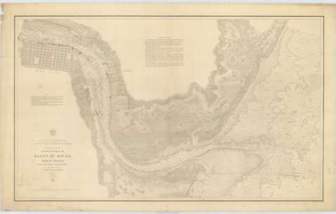
Title: Preliminary Chart Lower Reach of Saginaw river and Bar in Front : (Saginaw Bay, Lake Huron) / Surveyed under the direction of Captain J.N. Macomb. T.E. by W.H. Hearding, J.H. Forster, I.L. Beghern 1856 ; Engraved by W.H. Dougal
Material or type of resouce Area: Escala 1:10000
Publication: [Washington] : Bureau of Engineers of the War Department, [1867?]
Physical description: 1 carta náutica ; 59 x 98 cm
Content type: Imagen cartográfica
Media type: computadora
Carrier type: recurso en línea
Series: (Survey of the Northern and North Western Lakes)
Notes: Comprende parte del curso bajo del río Saginaw, desde la ciudad de Bay hasta su desembocadura en la bahía del mismo nombre en el lago Huron
Escala también dada en forma gráfica de 1 milla legal inglesa. Orientado con flecha la que señala además la variación magnética observada
Relieve por normales
Fecha tomada del sello que figura en el documento
En nota se explican las líneas de derrota a seguir para arribar a la bahía
Materia / lugar / evento: Cartas náuticas
Bahías
1856
1867
Saginaw (Bahía)
Other authors: Macomb, J. N
Dougal, W. H
Hearding, W.H
Forster, J.H
Beghern, I.L
Estados Unidos. War Department. Engineer Bureau
UDC: 774-11
Type of publication:
Maps
Rights:
Préstamo:
Disponible
