General topographical map. sheet XXIII : [U.S.A., Texas,...


 Maps, plans and nautical charts
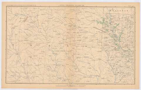
General topographical map. sheet XXIII : [U.S.A., Texas, Arkansas and Lousiana] (189-?)
Maps, plans and nautical charts
General topographical map. sheet XXIII : [U.S.A., Texas, Arkansas and Lousiana] (189-?)
 Disponible Holdings
 Section: Maps, plans and nautical charts
Title: General topographical map. sheet XXIII : [U.S.A., Texas, Arkansas and Lousiana]
Material or type of resouce Area: Escala [ca. 1:633594], 10 miles to 1 inch
Publication: Washington : Government Printing Office, [189-?] (N.Y. [Nueva York] : Julius Bien & co.)
Physical description: 1 mapa : col. ; 42x70 cm, en h. de 47x75 cm
Content type: Imagen cartográfica
Media type: computadora
Carrier type: recurso en línea
Notes: En : Atlas to accompany the Official Records of the Union and Confederate Armies 1861-1865. - Plate CLVIII
En : Atlas to accompany the Official Records of the Union and Confederate Armies 1861-1865
Materia / lugar / evento: Guerra civil
Mapas topográficos
Divisiones administrativas
Redes de transporte
S.XIX
Texas
Luisiana (Estados Unidos, Estado)
Arkansas
Estados Unidos
UDC: (73)
Type of publication:
Maps
Rights:
Préstamo:
Disponible
