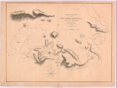
Part of the south coast of the Island of Antigua


 Maps, plans and nautical charts
Part of the south coast of the Island of Antigua (29th. september 1809)
Maps, plans and nautical charts
Part of the south coast of the Island of Antigua (29th. september 1809)
 Disponible Holdings
 Section: Maps, plans and nautical charts
Title: Part of the south coast of the Island of Antigua / Drawn from various surveys by A. Arrowsmith hidrographer to H.R.H. the Prince of Wales ; engraved by E. Jones
Material or type of resouce Area: [Ca. 1:8312], 1000 yards [= 11 cm]
Publication: London : published by A. Arrowsmith, 10 Soho Square, 29th. september 1809
Physical description: 1 carta náutica ; 40 x 60 cm
Content type: Imagen cartográfica
Media type: computadora
Carrier type: recurso en línea
Notes: Orientado con lis en rosa de los vientos
Relieve por sombreado
Indica sondas batimétricas
Toponimia costera de los principales accidentes geográficos y núcleos de población más significativos
Other authors: Arrowsmith, Aaron, 1750-1823
Jones, Edward, fl. 1807
UDC: 729.7
Type of publication:
Maps
Rights:
Préstamo:
Disponible
