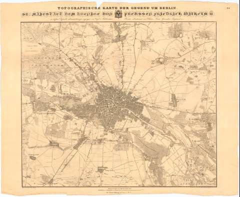
Topographische Karte der Gegend un Berlin...


 Disponible Holdings
 Section: Maps, plans and nautical charts
Uniform title: BERLIN (Alemania). Mapas generales. 1:25000 (1850)
Title: Topographische Karte der Gegend un Berlin... / Gestochen von I.C. Richter... [et al.] ; Aufgenomen und gezeichnet von Vogel v. Falckenstern
Material or type of resouce Area: Escala 1:25.000
Publication: Berlin : Bei Simon Schropp et Comp., 1850
Physical description: 1 mapa ; 59x68 cm en h. de 66x84 cm
Content type: Imagen cartográfica
Media type: computadora
Carrier type: recurso en línea
Notes: Escala grafica de 1000 Ruthen [= 15 cm]
Relieve representado por normales
Indica cultivos y masas forestales
En el margen superior '14'
Materia / lugar / evento: Mapas generales
1850
Other authors: Berge
Richter, J.C
Brose, H
Simon Schropp'sche Hof-Landkartenhandlung
UDC: 912(430 Berlin)'1850'
430 Berlin
Type of publication:
 Maps
Maps
Rights:
Préstamo:
Disponible
