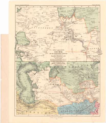
Specialkarte von Chiwa und den Umliegenden Gebieten zur...
Section: Maps, plans and nautical charts
Title: Specialkarte von Chiwa und den Umliegenden Gebieten zur orientirung der Russischen Kriegszuges / von A. Petermann
Material or type of resouce Area: Escala 1:4000000 ; [proyec. conica] (E39°0'-E40°0'/N44°30'-N40°0')
Publication: Gotha : Justus Perthes, 1873 (Gotha< : druck Melfarth)
Physical description: 1 mapa : col. ; 16x24 cm en h. de 35x30 cm
Content type: Imagen cartográfica
Media type: computadora
Carrier type: recurso en línea
Notes: Pertenece al 'Petermann's Geographischen Mittheihingen'
Escalas graficas de 10 Millas alemanas [= 3 cm], 100 Km [= 2 cm], 100 millas rusas [= 2 cm]. Red geografico de 1° en 1°
Relieve representado por normales
Procede de la 'Colección Rico y Sinobas'
Ubersichtskarte von West - Turkestan
Materia / lugar / evento: Mapas generales
1873
Other authors: Petermann, Augustus Herman
Hellfarth, C
Perthes, Justus, 1749-1816
UDC: 912(47+57)'1873'
47+57
Type of publication:
![]() Maps
Maps
Préstamo:
![]() Disponible
Disponible


