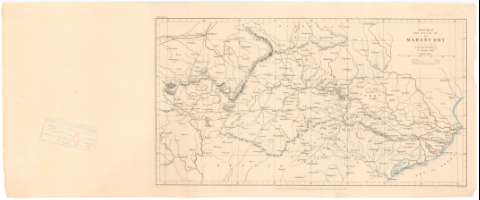
Sketch Map of The Basin of The Mahanuddy : Central India


 Disponible Holdings
 Section: Maps, plans and nautical charts
Uniform title: India. Mapas generales. 1:2700000 (1865)
Title: Sketch Map of The Basin of The Mahanuddy : Central India / R. Temple Esgre.
Material or type of resouce Area: Escala [ca. 1:2.700.000], 100 English Miles [= 6,5 cm]
Publication: London : Published for The Jornal of The Royal Geographicae Society by J. Murray Albemarle Street (1865)
Physical description: 1 mapa ; 19x34 cm en h. de 22x53,5 cm
Content type: Imagen cartográfica
Media type: computadora
Carrier type: recurso en línea
Notes: Coordenadas referidas al parecer al meridiano de Londres (E79°0'-E87°0'/N23°20'-N19°40'). Red geografica de 1° en 1°
Relieve representado por normales
Tabla de signos convencionales para indicar los ferrocarriles y carreteras
Materia / lugar / evento: Mapas generales
1865
Other authors: Temple Esqre, R
Murray, John
UDC: 912(540-191.2)'1865'
540-191.2
Type of publication:
 Maps
Maps
Rights:
Préstamo:
Disponible
