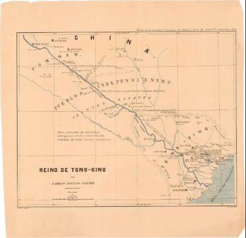
Reino de Tong - King


Section: Maps, plans and nautical charts
Uniform title: TONKIN (Región). Indochina. Mapas generales (1877). 1:500000
Title: Reino de Tong - King / por D. Emilio Augusto Sorilere ; Osler Aut. ; Lit. de Ruiz
Material or type of resouce Area: Escala 1:500000 ; [proyec. Cónica]
Publication: [Madrid ? : [Editor no identificado]], Setiembre 1877
Physical description: 1 mapa : col. ; 29,5x37 cm en h. de 40x40,5 cm
Content type: Imagen cartográfica
Media type: computadora
Carrier type: recurso en línea
Notes: Pertenece al 'Boletin de la Sociedad Geografica de Madrid Tomo III - Lama - 3
Escala grafica de 100 Km [= 7 cm]. Coordenadas referidas al meridiano de Hierro (E120°-G125°15'/N23°40'-N20°0'). Red geografica de 1° en 1°
Nota sobre el gran mercado de las tribus aborigenes y su relación con las minas anriferas
Materia / lugar / evento: Mapas generales
1877
UDC: 912[591-328 Tonkin]'1877'
591-328 Tonkin
Type of publication:
 Maps
Maps
Rights:
Préstamo:
 Disponible
