Port Campbell on The Andaman Islands


Section: Maps, plans and nautical charts
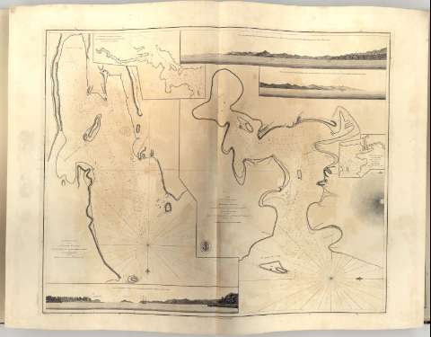
Title: Port Campbell on The Andaman Islands / by Lieut Archibald Blair
Material or type of resouce Area: Escala Indeterminada
Publication: [London?] : Published according to Act of Parliament by A. Dalrymple, 1794
Physical description: 1 carta náutica ; 57 x 67 cm en h. de 64,5 x 88 cm, pleg 49 x 65 cm
Content type: Imagen cartográfica
Media type: computadora
Carrier type: recurso en línea
Notes: Presenta además 3 vistas del Puerto de Campbell y 1 mapa de detalle
En: "Chart Red 5ea"
Orientado con lis en nudo de rumbos
Indica sondas batimétricas, veriles, bajos y fondeaderos
Sello de "Hydrographical office"
Other authors: Blair, Archibald
Dalrymple, Alexander
UDC: 912:(551.46:627.22:551.42)(540 Andaman islas)'1789/1794'
540 Andaman islas
Type of publication:
 Maps
Maps
Rights:
Préstamo:
 Disponible
