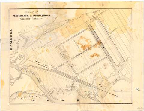
Plan zur Verbesserung des Hammerbrooks


Section: Maps, plans and nautical charts
Uniform title: HAMBURGO (Alemania). Canales (1841). 1:5000
Title: Plan zur Verbesserung des Hammerbrooks / von William Lindley
Material or type of resouce Area: Escala [ca. 1:5000]
Publication: Berlin : tith Himmel herber a heyer, 1841
Physical description: 1 plano ; 28,5x37 cm en h. de 33x43 cm
Content type: Imagen cartográfica
Media type: computadora
Carrier type: recurso en línea
Notes: Sello en seco de Simon Schropp & Co. Berlin
Other authors: Lindley, William
Himmelheber & Meyer
UDC: 912:626.1(430 Hamburgo)'1841'(083.9)
430 Hamburgo
Type of publication:
 Maps
Maps
Rights:
Archivo Cartográfico de Estudios Geográficos del Centro Geográfico del Ejército
Location: AR — Call number: Ar.H-T.10-C.7-87 — Código de barras: 2212922
Préstamo:
 Disponible

© Ministerio de Defensa de España
P. de la Castellana, 109 28071 Madrid.
Tlf: (34) 91 395 50 00
Email: patrimonio.cultural@oc.mde.es