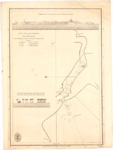
Plan of Billiapattam River


Section: Maps, plans and nautical charts
Uniform title: India. Cartas náuticas (1792). 1:46000
Title: Plan of Billiapattam River / by John David Spaeth ; W. Harrison sc.
Material or type of resouce Area: Escala [ca. 1:46000], 5 nautic miles [= 20,2 cm]
Publication: [London ?] : Published according to Act of Parliament by A Dalrymple Novn. 1st..., 1792
Physical description: 1 carta náutica ; 34,1x25,3 cm
Content type: Imagen cartográfica
Media type: computadora
Carrier type: recurso en línea
Notes: Presenta además 1 vista
Orientada con lis en cuadrante
Relieve representado por sondas batimétricas
Indica veriles
Relación de las torres y bancos indicados por clave alfabética
Nota relativa a las profundidades
Sello de la Hydrographical Office
Other authors: Spaeth, John David
Dalrymple, Alexander
Harrison, W
UDC: (540-15)
Type of publication:
 Maps
Maps
Rights:
Préstamo:
 Disponible
