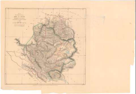
Map of the Country between Leh and Ilchi : Showing the...


 Maps, plans and nautical charts
Map of the Country between Leh and Ilchi : Showing the routes taken by Mr. Johnson, Civil Assit. G.T. Survey (1887)
Maps, plans and nautical charts
Map of the Country between Leh and Ilchi : Showing the routes taken by Mr. Johnson, Civil Assit. G.T. Survey (1887)
 Disponible Holdings
 Section: Maps, plans and nautical charts
Uniform title: India. Mapas generales. 1867 (1865). 1:2000000
Title: Map of the Country between Leh and Ilchi : Showing the routes taken by Mr. Johnson, Civil Assit. G.T. Survey / Edwd. Weller
Material or type of resouce Area: Escala [ca. 1:2000000], 50 english miles [= 4 cm]
Publication: London : Published for the Journal of the Royal Geographical Society by J. Murray Allernale Steet, 1887
Physical description: 1 mapa : col. ; 23,5x24,5 cm en h. de 27,5x41 cm
Content type: Imagen cartográfica
Media type: computadora
Carrier type: recurso en línea
Notes: Relieve representado por normales
Tabla de signos convencionales para indicar las rutas de Mr. Johnson
Notas manuscritas a lápiz
Materia / lugar / evento: Mapas generales
Itinerarios
1865
Leh
Ilchi
Other authors: Weller, Edward
Munray, John
UDC: 912:656.02(540-17)'1865'
(540 Leh)
(540 Ilchi)
Type of publication:
Maps
Rights:
Préstamo:
Disponible
