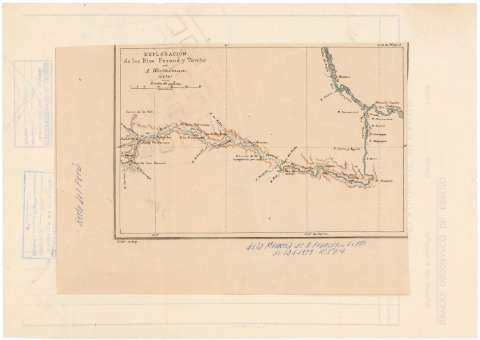
Exploración de los Ríos Perené y Tambo


Section: Maps, plans and nautical charts
Title: Exploración de los Ríos Perené y Tambo / por A. Wertheman (1876) ; Osler autogr
Material or type of resouce Area: Escala 1:1000000
Publication: [Lugar de publicación no identificado] : [Editor no identificado]], 1876
Physical description: 1 mapa : col. ; 14 x 22 cm
Content type: Imagen cartográfica
Media type: computadora
Carrier type: recurso en línea
Notes: Comprende los ríos Perené, Tambo y parte del Ucayali y Urubamba, en la parte central de Perú
Escala gráfica de 50 km [= 5 cm]. Coordenadas referidas a los meridianos de Hierro (E 302°49'--E 304°38'/S 10°20'--S 11°33') y Madrid (O 71°42'--O 69° 53')
Orografía represenada mediante sombreado
Iluminado con varios colores
Toponimia de los afluentes de los ríos mencionados y de los núcleos de población existentes a lo largo de su curso
Nota posterior manuscrita : "De la Memoria de D. Francisco Coello de 12-9-1878- Rl. Sd. Gca."
Materia / lugar / evento: Mapas hidrográficos
Expediciones geográficas
1876
Junín
Tambo (Perú) (Junín) (Río)
Other authors: Wertheman, A
Osler, G
UDC: 912:551.48:910.4(851.3)"1876"
851.3
Type of publication:
 Maps
Maps
Rights:
Préstamo:
 Disponible
