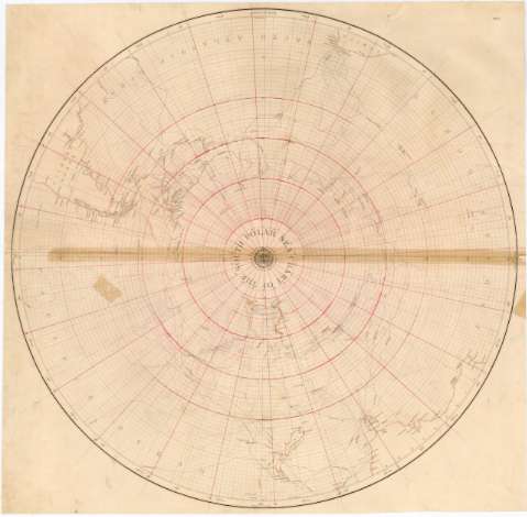
Chart of the South Polar Sea


Section: Maps, plans and nautical charts
Uniform title: POLO SUR. Expediciones geográficas. 1:22000000 (1839)
Title: Chart of the South Polar Sea
Material or type of resouce Area: Escala [ca. 1:22000000 ; proyec. equivalente de Lambert] (O180°-E180°/S30°-S90°)
Publication: London : Publd. according to Act of Parliament at the Hydro Office of the Admiralty and Sold by R.B. Date 21 Poultry, 1839
Physical description: 1 mapa : col., montado sobre tela ; 61,5 cm diám.
Content type: Imagen cartográfica
Media type: computadora
Carrier type: recurso en línea
Notes: Escala hallada a partir de un grado de latitud [= 0,5 cm]. Red geográfica de 10° en 10°
Indica las rutas de los viajes de Cook
Sello del Hydrographic Office
Materia / lugar / evento: Expediciones geográficas
Derroteros
1839
Other authors: Gran Bretaña. Hydrographic Department
UDC: 912:[910.4:527.6](99)'1800'
99
Type of publication:
 Maps
Maps
Rights:
Préstamo:
 Disponible
