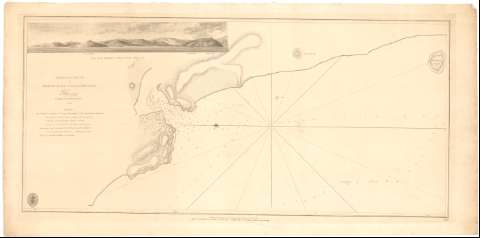
Chart of the mouth of Merjer River on Coast of Malabar


 Disponible Holdings
 Section: Maps, plans and nautical charts
Title: Chart of the mouth of Merjer River on Coast of Malabar / P. Tteywod Captain in the Royal Navy
Material or type of resouce Area: Escala indeterminada
Publication, Production, Distribution, etc.: Publicación: [London ?] : Publish'd according to Act of Parliament by A. Dabrymple 7th May..., 1806
Fabricación: [London ?] : sold by R.B. Bate 21. Poultry for the Lords Commifs rs. of the Admiralty by their Appointment, 1806
Physical description: 1 Carta náutica ; 33,6x67,9 cm
Content type: Imagen cartográfica
Media type: computadora
Carrier type: recurso en línea
Notes: Presenta 1 vista
Relieve representado por normales
Indica veriles y sondas batimétricas
Nota relativa a la situación de la costa
Sello de la Hydrographical Office
Materia / lugar / evento: Cartas náuticas
Ríos
Costas
1803
Tadri (Río)
Other authors: Tteywod, P
UDC: 912:[551.46:556.53:551.468](540-328 Malabar)'1803'
540-328 Malabar
Type of publication:
 Maps
Maps
Rights:
Préstamo:
Disponible
