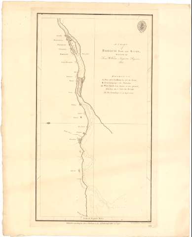
Chart of Broach Bar and River, A


Section: Maps, plans and nautical charts
Title: Chart of Broach Bar and River, A / furveyed by Lieut. William Augustus Skynner ; Mw. Smith, sculpt. Pupil to Mr. Whitchurch Islington
Material or type of resouce Area: Escala [ca. 1:190000], 20 nautick miles [= 20 cm]
Publication: [London ?] : Publish'd according to Act of Parliament by A. Dalrymple, Feby. 25th..., 1775
Physical description: 1 Carta náutica ; 41,8x33,9 cm
Content type: Imagen cartográfica
Media type: computadora
Carrier type: recurso en línea
Notes: Orientado con lis en cuadrante
Indica veriles, fondeaderos y sondas batimétricas
Relación de lugares y ciudades indicadas por clave alfabética
Sello del Hidrographical Office
Other authors: Skynner, William Augustus
Dalrymple, Alexander
Smith, Mw
UDC: 912:[551.46:556.53](540-282.2 Broach)'1775/1776'
Type of publication:
 Maps
Maps
Rights:
Préstamo:
 Disponible
