Asien


Section: Maps, plans and nautical charts
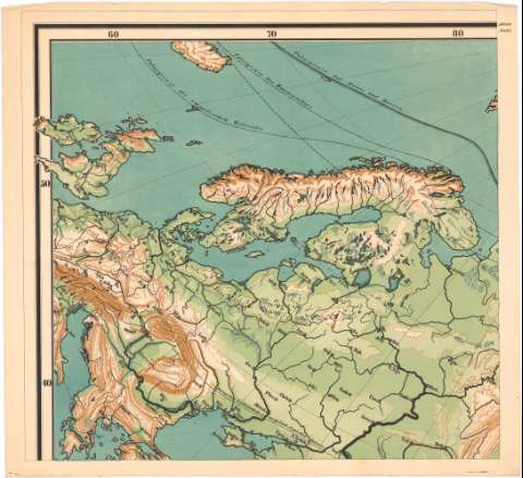
Uniform title: Asia. Mapas generales. 1:80000000 (185)
Title: Asien / von E. von Sydow
Material or type of resouce Area: 1:80000000 ; [proyec. ortográfica horizontal]
Publication: Gotha : Justus Perthes, [185-?] (lithographie und buntdruck von A. Endert)
Physical description: 1 mapa en 9 h. : col. ; 151,5 x 163,5 cm en h. de 50,5 x 54, 5 cm
Content type: Imagen cartográfica
Media type: computadora
Carrier type: recurso en línea
Notes: Comprende toda Asia y parte de Europa oriental
Escala gráfica además de 100 millas alemanas [= 9,4 cm]. Coordenadas referidas, al parecer, al meridiano de Hierro (E 10°-O 140°/N 80°-S 20°). Red geográfica de 10 en 10°
Relieve representado por normales
En el margen superior, numeración de las secciones u hojas
Materia / lugar / evento: Mapas generales
S.XIX
Europa Oriental
Asia
Other authors: Sydow, E. von
Endert, A
Perthes, Justus, 1749-1816
UDC: 912(5)'1850/1859'
5
Type of publication:
 Maps
Maps
Rights:
Préstamo:
 Disponible
