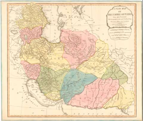
A new map of the empire of Persia


Section: Maps, plans and nautical charts
Uniform title: IRAN. Mapas generales (17). 1:4600000
Title: A new map of the empire of Persia / From Monsr. D Anville Firft Geographer to the most Christian King
Material or type of resouce Area: Escala [ca. 1:4600000], 60 Great Parasanas or Persian Leagues about 17 in a Degree [= 8'5 cm] ; [proyec. cónica]
Publication: London : Published by Laurie & Whittle, 53 Fleet Steet as the Ace Directs. 12th, May. 1794
Physical description: 1 mapa : col., montado sobre tela ; 50'6x57'4 cm en h. de 53'5x63'3 cm
Content type: Imagen cartográfica
Media type: computadora
Carrier type: recurso en línea
Notes: Escalas gráficas de 100 parasangs comunes de 25 al grado [= 9'6 cm], 80 millas de Arabia de 50 al grado [= 7'6 cm] y 200 millas británicas de 69 1/2 al grado [= 6'9 cm]. Coordenadas referidas al meridiano de Hierro (E64°30'-E85°28'/N10°36'-N24°40'). Red geográfica de 5° en 5°
Relieve de perfil
Materia / lugar / evento: Mapas generales
Divisiones administrativas
Topónimos antiguos
1794
Irán
UDC: 912(55)'17'
55
Type of publication:
 Maps
Maps
Rights:
Préstamo:
 Disponible
