A New General Atlas : whit the Divisions and Boundaries...


 Maps, plans and nautical charts
A New General Atlas : whit the Divisions and Boundaries Carefully coloured (1840)
Maps, plans and nautical charts
A New General Atlas : whit the Divisions and Boundaries Carefully coloured (1840)
 Disponible Holdings
 Section: Maps, plans and nautical charts
Uniform title: Mundo. Mapas generales (1853). Varias escalas
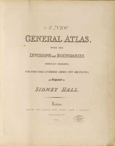
Title: A New General Atlas : whit the Divisions and Boundaries Carefully coloured / Constructed entirely from new drawings, and Engraved by Sidney Hall ; Printed for Longman, Orme, Brown, Green & Longmans
Material or type of resouce Area: Escalas diferentes
Publication: London : Longman, Orme & Co., 1840
Physical description: 1 atlas (55 h) : 53 map., col. ; 63 x 51 cm
Content type: Imagen cartográfica
Media type: computadora
Carrier type: recurso en línea
Notes: Presenta 53 mapas generales de la totalidad de los países del mundo, atendiendo tanto a su orografía, ríos y núcleos de población más significativos, como a la división política dse esos países y sus divisiones administrativas internas
Graduado respecto al meridiano de Greenwich
Líneas divisorias lavadas en varios colores, y representación del relieve a base de normales
Encuadernado, presentando el siguiente título en portada : "Hall's Atlas"
Presenta índice referencial de los documentos que contiene"
Materia / lugar / evento: Mapas generales
Divisiones administrativas
Other authors: Hall, Sydney
Longman, Orme and Co (Londres)
UDC: 912(100-35)"1840"
100-35
Type of publication:
Maps
Rights:
Préstamo:
Disponible
