The West Indian Atlas or a general description of the...


 Maps, plans and nautical charts
The West Indian Atlas or a general description of the west Indies : Taken from actual surveys and observations (1775)
Maps, plans and nautical charts
The West Indian Atlas or a general description of the west Indies : Taken from actual surveys and observations (1775)
 Disponible Holdings
 Section: Maps, plans and nautical charts
Uniform title: Caribe (Mar). Cartas náuticas (1775). Varias escalas
Title: The West Indian Atlas or a general description of the west Indies : Taken from actual surveys and observations / by Thomas Jefferys, Geographer to the King
Material or type of resouce Area: Varias escalas
Publication: London : Printed for Robt. Sayer & John Bennett, Map and Printsellers, n°53 in Fleet Street, 1775
Physical description: 1 atlas ([4]hoja, 28 páginas, [75]h) : 39 mapas ; 54 cm
Content type: Imagen cartográfica
Media type: computadora
Carrier type: recurso en línea
Notes: Presenta un amplio texto introductorio con datos geográficos, históricos y económicos de las zonas representadas
Escalas gráficas expresadas generalmente en leguas marinas y en millas. Coordenadas referidas a los meridianos de Ferro y Londres. Orientados con lis
Relieve de perfil y por normales. Indica sondas batimétricas
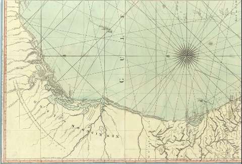
Contenido incompleto: Plate A. A Chart of the British Channel -- Plate B. The Atlantic Western Ocean -- Plate C. The Açores or Wesern Islands -- Plate D. The Madeiras, and of Canary Islands -- Plate E. The Cape de Verd Islands -- Plate F. The Bermudas or Summer's Islands -- Plate 1. The General Index - Map of the West - Indies. -- Plate 2. The Western Coast of Lousiana, and the Coast of New Leon -- Plate 3. The Coast of West Florida and Louisiana -- Plate 4. The Peninsula and Gulf of Florida, and the Bahamas Islands -- Plate 5. The Coast of Yucatan, from Laguna de Esmotes to Punta Brava -- Plate 6. The coast of Yucatan, from Campeche to Bahia del Ascension, with the West End of Cuba -- Plate 7. The Island of Cuba, with part of the Bahama Banks and The Martyrss -- Plate 8. The Windward Passage, with the several passages from the west End of Cuba, and the North Part of St. Domingo -- Plate 9. The Coast of New Spain from Neuva Vera Cruz to Trieste Island -- Plate 10. The Bay of Honduras -- Plate 11. The Island of Jamaica, and Cape Gracias a Dios, with the Banks -- Plate 12. The South Part of Domingo -- Plate 13. The Caribee Islands, the Virgin Islands, and Porto Rico -- Plate 14. Part of the Provinces of Costa Rica and Nicaragua, with the Lagunas -- Plate 15. The Isthmus of Panama, with the coasts from the great River on the Moskito Shore to Carthagena -- Plate 16. The Coast of Terra Firma, from Carthagena to Golfo Trieste -- Plate 17. The Coast of Caracas, Cumana, Paria, and the Mouths of Rio Orinoco, with the Islands of Trinidad, Margarita, Tobago, Granada, St. Vincent & c. -- Plate I. The Island of Jamaica -- Plate II. The Island of Ruattan, or Roattan, with the Island or Old Provindence -- Plate III. The Virgin Islands, with the Islands of Anguilla, Saba, St. Eustatia, St. Martin's, the Great Passage Island, and Crab Island, with a Part of Porto Rico -- Plate IV. The Island of St. Chistopher, and the Island of Nevis -- Plate V. The Island of Antigua -- Plate VI. The Island of Guadaloupe, with the Island of Mariegallante -- Plate VII. The Island of Dominica -- Plate VIII. The Island of Martinica -- IX. The Island of St. Lucia -- Plate X. The Island of Barbadoes -- Plate XI. The Island of St. Vicent -- Plate XII. The Island of Beguia, or Becochya -- Plate XIII. The Island of Granada -- Plate XIV. The Island of Tobago -- Plate XV. Turks Islands -- Plate XVI. The Island of Curaçao
Materia / lugar / evento: Mapas generales
Cartas náuticas
Golfos
Derroteros
Atlas
1775
México
América Central
Other authors: Jefferys, Thomas, ca. 1710-1771
Bennett, John
Sayer, Robert, 1725-1794
UDC: (728/729)
Type of publication:
Maps
Rights:
Préstamo:
Disponible
