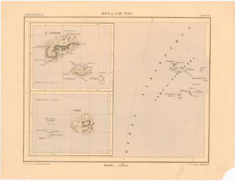
Iles du Cap Vert


Section: Maps, plans and nautical charts
Uniform title: Cabo Verde. Mapas generales (186). 1:5555000
Title: Iles du Cap Vert / dessiné et gravé par R. Hausermann
Material or type of resouce Area: Escala 1:1555000 ; [proyec. cónica]
Publication: París : Imp. J. et A. Lemercier, [186- ?]
Physical description: 1 mapa : col. ; 20,5x26,4 cm en h. de 25x33 cm
Content type: Imagen cartográfica
Media type: computadora
Carrier type: recurso en línea
Notes: Pertenece a 'La Gazzette Geographique'
Coordenadas referidas, al parecer, al meridiano de Paris (O35°-O25°/N20°-N10°). Red geografica de 5° en 5°
Releive representado por normales
Inserta : St. Antoine.- Escala 1:730000. Fogo.- Escala 1:730000
Materia / lugar / evento: Mapas generales
S.XIX
Other authors: Hausermann, R
Lemercier
UDC: 912(665.8)'1860/1869'
665.8
Type of publication:
 Maps
Maps
Rights:
Préstamo:
 Disponible
