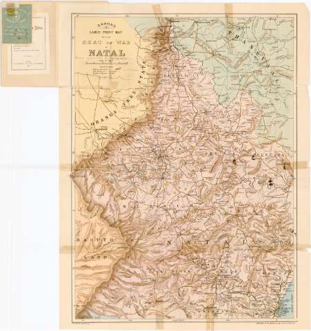
Bacon's Large - Print Map of the Seat of War in Natal


 Disponible Holdings
 Section: Maps, plans and nautical charts
Title: Bacon's Large - Print Map of the Seat of War in Natal
Material or type of resouce Area: Escala [ca. 1:320000], 20 miles [= 10 cm] ; [proyec. cónica conforme] (E28°55'-E31°05'/S27°10'-S29°55')
Publication: London : G.W. Bacon & Co. Ltd. 127, Strand, 1900
Physical description: 1 mapa : col. ; 80,5x61,5 cm, pleg. en 40x61,5 cm
Content type: Imagen cartográfica
Media type: computadora
Carrier type: recurso en línea
Notes: Pertenece al 'Bacon's War - Maps. n 10'
Relieve representado por sombreado
Tabla de signos convencionales para indicar lineas ferroviarias y estaciones y carreteras
Acompañado de un cuadernillo 'Bacon's Large - Scale map of Natal. The South African Crisis'
Materia / lugar / evento: Mapas generales
1900
Other authors: G.W. Bacon & Co. (Londres)
UDC: 912(680-328 Natal)'1900'
680-328 Natal
Type of publication:
 Maps
Maps
Rights:
Préstamo:
Disponible
