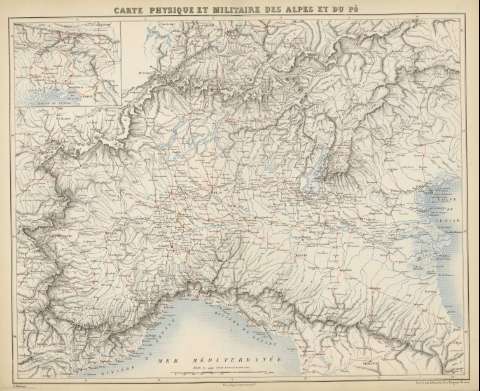
Carte Physique et Militaire des Alpes et du Po : [carte...
Section: Maps, plans and nautical charts
Title: Carte Physique et Militaire des Alpes et du Po : [carte de campagne pour l'intelligence de toutes nos campagnes d'Italie, et principalmente... 1796, 1800... 1866 / F. Bureau ; Gravé par Erhard, 12 Rue Duguay-Trouin
Author: Bureau, Édouard, 1830-1918
Material or type of resouce Area: Escala [1:102040]
Publication: [París : Furne, Jouvet et Cie., 1870] (Imp. Lemercier et Cie.)
Physical description: 1 mapa : col. , 40x49 cm, en h. de 43x52 cm, pleg. en 43x28 cm ; vv
Content type: Imagen cartográfica
Media type: computadora
Carrier type: recurso en línea
Notes: Coordenadas : E4 10'-E10 10'/N47 15'-N43 40'. Meridiano de París
Relieve sombreado
Inserta [mapa del golfo de Venecia y Territorios adyacentes]. - Escala 1:204080
Copia digital . España : Ministerio de Cultura y Deporte. Subdirección General de Coordinación Bibliotecaria, 2010
Materia / lugar / evento: Mapas militares
Geografía militar
Mapas físicos
Alpes (Italia)
Po (Italia)
Italia
Related titles: Italia. Geografía militar. [1870]. Ca. 1:102.040
UDC: 912:355:355.47
912:911.2:551.43(234 Alpes)(282.24 Po)(45.17)'1796-1866'
45
Type of publication:
![]() Maps
Maps


