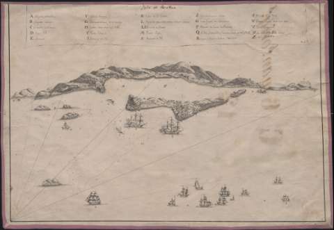
Ysla de Roatan


Section: Maps, plans and nautical charts
Uniform title: ROATÁN (Honduras) (Isla). Cartas náuticas (17--?)
Title: Ysla de Roatan / Rio fe[cit]
Material or type of resouce Area: Escala indeterminada
Publication: [1700-1799?]
Physical description: 1 vista : ms. sobre tela ; 34,1 x 49,7 cm
Content type: Imagen cartográfica
Media type: computadora
Carrier type: recurso en línea
Notes: Orientado con media lis
Clave alfabética localizadas embarcaciones, fuertes, baterías, islas, tierras, etc.
Sobre el mar naves de la época
Título en filacteria
Sondas, bajos y veriles
Materia / lugar / evento: Cartas náuticas
Roatán (Isla)
Honduras
Genre / form: Materiales cartográficos
Other authors: Río, José del
UDC: 728.3 Roatán
Type of publication:
 Maps
Maps
Rights:
Préstamo:
 Disponible
